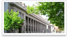
Historic Properties of Spokane
List properties by: Name | Address | Neighborhood | Historic District
Other / Outside City Limits
- 5807 S. Dearborn Road
- 5705 S. Custer Road
- 21918 W. Four Mound Road, Nine Mile Falls
- 3609 W. Thorpe Road
- 16704 N. Dartford Drive, Spokane County
- 5821 W. Rutter Parkway
- 8500 N. St. Michaels Road
- 4702 N. Fruithill Road, Spokane County
- 5520 W. Thorpe Road, Spokane County
- 10627 S. Highway 27, Mica, WA 99036
- 13219 W. 1st Avenue, Four Lakes, WA 99014
- 1399 S. Dover Road, Medical Lake WA 99022
- 10700 S. Jackson Road, Mica WA 99023
- 11300 W. Chapman lake Road, Cheney 99004
- 5694 W. Rutter Parkway
- 12308 E. Upriver Drive, Spokane County
- 13501 N. Nine Mile Road, Nine Mile Falls WA 99026
- 6616 E. Orchard Rd
- 12114 E. Sprague Avenue
- 329 N. Pine Street, Latah WA 99018
- 515 N. Main, Latah WA 99018
- 9613 . Cheney-Spokane Road, Marshall WA 99224
- 3318 N. Marguerite Road, Millwood WA 99212
- W. Mile Marker 2, Centennial Trail
- 14701 N. Oxford Road, Nine Mile Falls
- 12720 N. Vistawood Ct
- 1005 E. 54th Ave
- 306 W. Graves
Neighborhoods
- Balboa / South Indian Trail
- Bemiss
- Brownes Addition
- Chief Garry Park
- Cliff / Cannon
- Comstock
- East Central
- Emerson / Garfield
- Five Mile Prairie
- Grandview-Thorpe
- Hillyard
- Latah / Hangman Valley
- Lincoln Heights
- Logan
- Manito / Cannon Hill
- Minnehaha
- Nevada / Lidgerwood
- North Hill
- North Indian Trail
- Northwest
- Other / Outside City Limits
- Peaceful Valley
- Riverside
- Rockwood
- Southgate
- West Central
- West Hills
- Whitman